
Tourism in Carchi
Tourism in Carchi
CI
The province of Carchi has 170,000 inhabitants, 80,000 urban and 90,000 rural.
Carchi has an area of 3,600 square kilometers divided into 6 cantons.
Carchi was declared a province on November 19, 1880.
MUNICIPALITIES / CANTONS
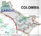
- Tulcán is the capital of the Carchi province, and is located on the border with Colombia.
Bolívar
Espejo
Montúfar
Mira
- Mira is in the south of the Carchi province.
Tourism in the
Carchi Province
Park in Tulcán
Carchi Province


Other cities and sites
Other provinces
Imbabura - Loja - Los Rios - Manabi - Morona Santiago - Napo - Orellana - Pastaza - Pichincha - Santa Elena
CAMARA DE TURISMO DEL CRCHI
Teléfono:
GOBIERNO DE LA PROVINCIA
Consejo Provincial del Carchi
Teléfono:


OTHER INTERESTING SITES
El Valle del Chota
- The famous Valle del Chota is in the south of the Carchi province.
- El Cementerio de Tulcán. Tulcán
- Lagunas "El Voladero". El Ángel
- Los Tres Chorros. Tulcán
- Feria de Tulcán
- Santuario de Nuestra Señora de La Purificación - Huaca
- Iglesia de El Ángel
- Ecoparque - Tulcán
- Museo Arqueológico de Bolívar
SITIOS NATURALES
Laguna La Encañada
Como su nombre lo indica, la represa está ubicada en una hondonada a la que le conocen como encañada. Está rodeada de colinas, bosques de pino, eucalipto, cultivos y pastizales. Este dique artificial, que en algún momento fue una formación natural, brinda a los visitantes un espacio de esparcimiento y recreación. Fuente: Fichas de Inventario Atractivos Turísticos del Ministerio de Turismo.
It is an area declared a National Ecological Conservation Reserve since 1986. Located 20 km southwest of the city of Tulcán with an area of 16,000 ha.
Volcán Chiles.
Young volcano and still considered active, with a height of 4,723 m s. no. m. It constitutes the highest peak in the province of Carchi and is considered a natural landmark of the Colombian-Ecuadorian border since the San Juan river to the West and the Carchi to the East are born from its perpetual snow, rivers that demarcate the political limits between these two countries. . From Tulcán you can access Tufiño, a small town located on the flanks of the volcano, through an asphalt road of about 18 km, from there continue about 7 km on a ballast road that leads to a refuge, from where the mountaineering expeditions depart in search of the top. On a clear day it is easy to see other surrounding volcanoes from its summit, such is the case of El Cumbal located a few kilometers to the north, already in Colombia and considered the older brother of Chiles, likewise the summits of Cotacachi, Imbabura, Cayambe, Pichincha and Antisana. In the surroundings of Tufiño, as well as on the slopes of the volcano, you can see the pajonal, the rosa urco, the frailejones and other plant and animal species typical of the páramo
Baños de Tufiño
To develop health tourism, taking advantage of the thermal or sulfurous waters produced by the Chiles volcano, on the western flanks of the volcano 5 km from Tufiño, a spa known as "Las Aguas Hediondas" has been installed, a name that comes from the smell emanating from the waters. sulphurous; Its pools have temperatures ranging from 59 °C (at the source outlet) to 40 °C (temperature of the vented water). Inside the spa there are facilities for tourists and a self-guided trail has been built around it where nature lovers can take walks and observe nature.
Lagunas verdes
3 km to the south west of the cone of the Chiles volcano is the Lagunas Verdes complex, a lake complex made up of 7 turquoise blue water mirrors due to the presence of sulfur, the result of the union of internal springs and slopes that originate from mother earth at 3900 m s. no. m.; the largest of them is called "Estigia" and is also known as "Goddess". In these natural reservoirs you can go fishing for trout, a fish that abounds in these waters, and in the early hours of the morning you can see small flocks of wild ducks.
Gruta de la Paz
10 km south of San Gabriel along the Pan-American highway, you reach the small town of La Paz, from there taking a detour to the west which runs along a narrow path of 4 km along the edge of notable precipices with a vertical drop of up to 300 meters, at the bottom of which we find the Apaquí river zigzagging, which in its millenary year of drilling into the mountain managed to cross it, forming an impressive grotto inside, inside which a Sanctuary has been installed in honor of the Virgin of La Paz, spiritual patron of the Carchenses , which is why it is very visited by tourists from the locality or from the south of Colombia who come in large pilgrimages for July 9, the day of its main festival.
This place has been declared a National Sanctuary in 1975 and in its vicinity we find several plaques of gratitude from the faithful who have received miracles from the Virgin, as well as crutches or wheelchairs from those who cured their ailments with faith in this Marian devotion. The sculpture of the Virgin was carved by the sculptor Daniel Reyes from Ibarra in 1916, who was inspired by Notre Dame de Paris as a prayer for the ceasefire in the First World War.
In the cave we find stalactites and stalagmites, which have been formed by the high concentration of limestone and the seepage of water. It is also easy to see bats that seem to fly to the deafening rhythm of the river.
Over the cave there is a convent of the Clarisas sisters, cloistered nuns. Here they have a tourist information place, which also allows the sisters to help themselves financially through the sale of religious souvenirs and tourist souvenirs. Next to the monastery we find a small but hotel, a restaurant, typical food stalls, parking lot and sanitary batteries available free of charge to visitors, in addition, very close to the cave and on the banks of the river there is a thermal water source, which has been used to feed a pool for recreation and fun for travelers.
Reserva Biológica Privada Guanderas
Biological conservation area of about 1000 ha, 60% corresponds to páramo and 40% to primary forest. The guandera tree (clusia-flaviflora) has its development in this biological station and reaches a height of up to 30 m. This reserve is owned by the Jatún Sacha Foundation and is located on the western edge of the central Andes mountain range, about 35 km south of the city of Tulcán. Its main access is through the Pan-American highway and then a secondary road is taken that leads us into the humid montane forests that are home to 140 endemic bird species and others that have been discovered on the site, such as the colored toucan, as well as other animal species such as the spectacled bear, an endangered species. Botanical gardens and greenhouses have been installed around the station.
Dozens of foreign tourists attend this reserve, who are brought by the Foundation to remain there for periods of between 15 days and 2 months, during which time they carry out community and agricultural work.
Bosque de los Arrayanes
Located 4 km west of San Gabriel. It is an ancient forest that was predominant in the province but due to the indiscriminate felling of peasants who turned their wood into charcoal, this forest has seen its extension reduced to only 10 ha and is unique in Ecuador and along with another located in Argentina , Unique in the world. The tourist will travel inside through a self-guided path under thick fronds that filter the sun's rays very effectively, but upon reaching the center of the forest, they will find an almost circular wasteland known as "La Catedral", so named in view of the fact that in In ancient times, the Pastos, the aborigines of this region, celebrated ceremonies and rituals in honor of their deity the Sun.
La Laguna del Salado
Laguna del Salado is the name given to an artificial reservoir built almost 100 years ago and located 3 km west of the town of San Gabriel (Montúfar Canton) and near the Arrayanes forest. With an area of 500 meters long by 200 meters wide, this reservoir was created to irrigate the last large estate in the province of Carchi, the Hacienda de El Vínculo owned by the Fernández Salvador family, which included land from Huaca to Valle of the Chota. Today the lagoon, surrounded by flora such as willows, sigses, totoras, orchids and inhabited by hummingbirds, owls and turtledoves, is used for recreation because its transparent waters and a moderate temperature of 12 °C make it a suitable place to enjoy its nature.
Cascada de Paluz
Located 3 km from San Gabriel, it is a 25 m high waterfall formed by the river of the same name, it has served as an inspiration for poets, painters and musicians due to its colorful landscapes.
Fuente: wikipedia, consejo provincial, etc.