
Tourism in the National Park Podocarpus
Tourism in the National Park Podocarpus
CI
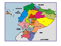
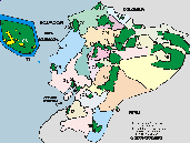
The Podocarpus National Park has an area of 146,280 hectares and was created on 01/05/1983 Official Registry A396-404.
The park is in the provinces of Zamora Chinchipe and Loja.
The Podocarpus National Park is close to the cities of Loja, Zamora and Vilcabamba, from where there are entrances to the park.
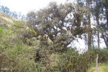
In the Podocarpus National Park you can go hiking and observe birds and the very special flora of the park.
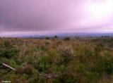
The Podocarpus National Park is located in an area of great biodiversity and endemism in the southern region of Ecuador. This makes it a clear testimony to the influence of mountains on tropical lands, one of the main reasons for Ecuador's extraordinary biodiversity.
Many studies show that most of the country's biodiversity is packed in these intermediate heights, where the cold is not so extreme and, instead, humidity, microclimates and geographical barriers abound. The area where Podocarpus is found is considered a site of global importance for the conservation of biodiversity.
For this reason, along with other areas in the area such as the Yacuri National Park and the Cerro Plateado Biological Reserve, since 2007 it has been part of the Podocarpus – El Cóndor Biosphere Reserve, a recognition granted by UNESCO.
This area is home to a large area of páramos, cloud forests and scrub areas, essential for the preservation and continuity of the ecosystems of southern Ecuador and northern Peru.

Other Natural o Protected Areas and Spots
Galapagos - Llanganates - Ilinizas - Chimborazo - Sangay - Yasuni - Cuyabeno - Machalilla - Cotopaxi


Gran Sumaco Napo Province Protected Areas
Cotopaxi Highlands Paramo Protected Area
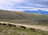
Horses Cotopaxi National Park
Protected Area

Arenillas Ecological Reserve
Podocarpus
National Park
OTROS SITIOS INTERESANTES
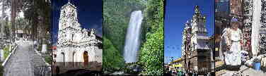
Loja is the capital of the province of Loja.
Vilcabamba is in the south of Loja, and is close to the Podocarpus Park.
Zamora is the capital of the province of Zamora Chinchipe.
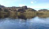
Lagunas del Compadre
They constitute one of the main tourist attractions of the park. It is a highly recommended site for those who like sport fishing and adventure. The best time to visit this sector is the month of November, when you can camp on its shores and explore the surroundings. With some luck it is possible to observe some relatively common species in the sector, such as the mountain tapir or the páramo wolf.
Cajanuma
In the Cajanuma sector there is a reception center for visitors with information about the park. In addition, it is the main entry point to the trail that leads to the Lagunas del Compadre. It has some self-guided and interpretative trails where it is possible to appreciate the representative flora of the sector, especially the cloud forest and, further up, the shrubby moor very typical of the park. It is a site of great importance for the observation of some species of birds and mammals of the high Andean areas.
Bombuscaro y Romerillos
There are two areas located in the eastern sector of the park. In Bombuscaro there is an environmental interpretation center and a multipurpose room for educational activities. On this site some self-guided trails have been established to observe typical flora and fauna species of the sector. A main attraction are the natural waterfalls that originate in the high Andean areas of the park. It is a highly recommended site for photography and bird watching.
Cerro Toledo
Located at the southern end of the park, 12 kilometers from the Yangana – Valladolid road, Cerro Toledo constitutes an important natural viewpoint from where it is possible to appreciate the forest and the typical topography of the southern Andes of the country. In addition, it constitutes a strategic site for the observation of birds and some species of mammals.
Fuentes: areasprotegidas.ambiente.gob.ec