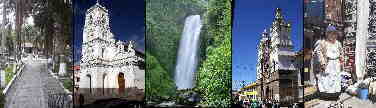

Tourism in the Sumaco National Park
Tourism in the Sumaco National Park
Sumaco
National Park
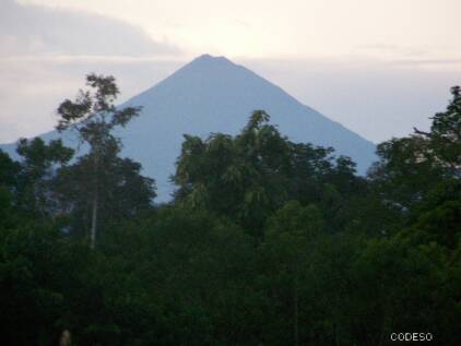
El volcán Sumaco
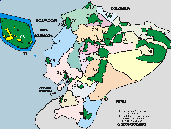
The Sumaco National Park has 205,249 ha, with two sectors: the zone of the Sumaco volcano and its adjacent areas (190,562 ha) and the zone of the Cordillera de Galeras (14,687 ha), and is located in the northeast of Ecuador, between the provinces of Napo and Orellana.
It receives a precipitation of 2000 -6000 m, and includes the Sumaco and Pan de Azúcar volcanoes, as well as the Negro and Galeras hills (Valarezo et al. 2002).
The vegetation is Páramo de pajonal, montane cloud forest, lower montane evergreen forest, foothill evergreen forest, lowland evergreen forest and lower montane humid scrub.
The Sumaco volcanic cone constitutes an ecological island of montane forests, and presents endemic fauna.
CI

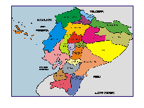
Other Natural o Protected Areas and Spots
Galapagos - Llanganates - Ilinizas - Chimborazo - Sangay - Yasuni - Cuyabeno - Machalilla - Cotopaxi


Gran Sumaco Provincia Napo Areas Protegidas
Lagunas Cuyabeno Provincia Sucumbios Areas Protegidas
- The Antisana Ecological Reserve is in the eastern part of the Napo province.
- The Cayambe Coca Ecological Reserve is in the north of the Napo province.
- In the south of the Napo province is the eastern entrance to the Llanganates National Park. One entry point is the village of Talag.
- Archidona is located in the north near Tena, and has different tourist attractions.
El Chaco
- The El Chaco canton is in the north of the province. Here, as also in Baeza, you can find cheeses and other dairy products and try fresh trout.
- Papallacta is between Quito and Baeza and is famous for its hot water baths, where you can rest from the trip. The Papallacta lagoon forms the drinking water reserve of Quito and in its surroundings there are trout to fish and lagoons to bathe.
La Cascada San Rafael
- The San Rafael Waterfall was (it dosnot exist anymore) one of the most impressive waterfalls in the eastern part of Ecuador. The waterfall has a drop of more than 150 meters, forming the Coca River beyond. The entrance to the San Rafael Waterfall is located right on the border of the Napo and Sucumios provinces on the Quito - Nueva Loja highway (Lago Agrio). You walk for half an hour from the road to the waterfall, and on the way you can observe rich flora and take advantage of a bath in small waterfalls of crystalline water.
- Puerto Misahuallí is bequeathed from Puerto Napo in the south of Tena. It is the port for the boats in the Napo river. From here you can also reach the Jatun Sacha Biological Station.
Las Cuevas de Jumandi
- The Jumandí caves are close to Archidona and are a tourist attraction not to be missed.
Entrance: On the Baeza - Tena road, at km 24, Narupa sector, continue along the Hollín - Loreto road until you reach the sector called Wawa Sumaco. From here continue to the community of Pacto Sumaco where the entrance to the park is located.